 By Aidan Sowa · October 2026 · Spring Branch East, Texas
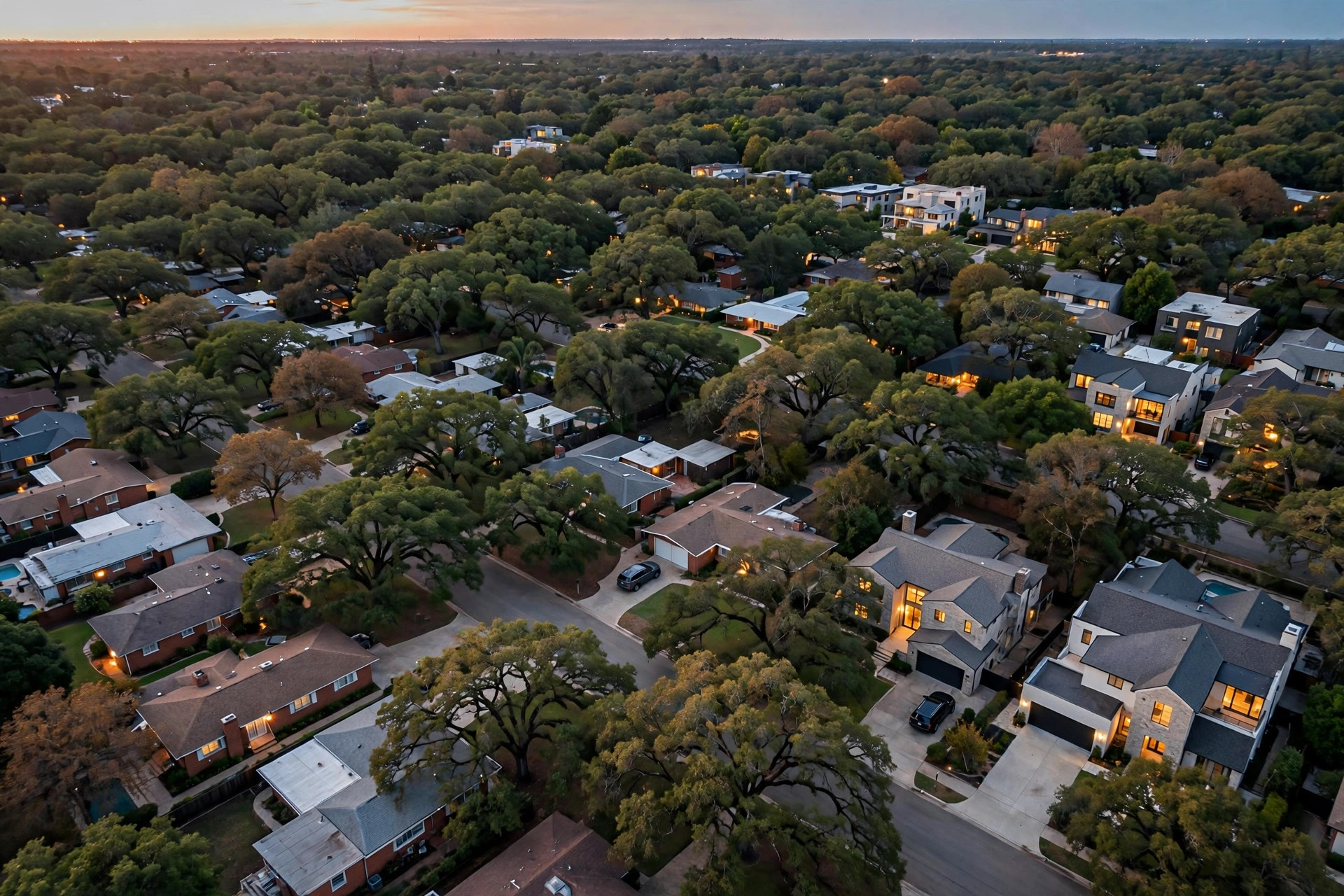
Within Spring Branch East, replacement construction concentrates in the pockets the research actually documents: the ranch streets around Kempwood, the Long Point Corridor, the residential blocks off Gessner, and the blocks toward the I-10 corridor. Those are the areas the source material names when it describes where the 1950s and 1960s brick ranch stock stands, where lots run deep, and where corridor position lifts finished prices. Across the ZIP code as a whole, builders acquired 9 of the 19 older homes sampled, a replacement demand rate of 47.4 percent (Frontier Capitals, 2026), and new construction on standard lots has sold from 750,000 dollars to 1,050,000 dollars (Redfin, 2026). Where an older ranch stands on a lot of 8,751 square feet or more within reach of the corridor, the odds that its next chapter is a new build are the highest in the neighborhood.
A precision limit belongs at the front of this answer. The source material publishes no per street or per pocket count of replacements, and no subdivision level tally exists in the record, so this report cannot crown a single block with a number. What it can do is apply the documented method: replacement follows the intersection of old stock, lot size, and finished price strength, and it can be traced parcel by parcel in permit records (Harris County Appraisal District, 2026). Read that way, the named pockets above are where the three conditions overlap most completely, and the rest of this report shows the working.
Key Findings
- Builders acquired 9 of 19 sampled older homes in 77055, a rate of 47.4 percent (Frontier Capitals, 2026).
- The documented ranch stock stands along Kempwood and Long Point and on the residential blocks off Gessner (Frontier Capitals, 2026).
- Sampled lots started at 8,751 square feet, and many neighborhood lots run to 10,000 square feet or more (Frontier Capitals, 2026).
- On a standard lot here, a newly built home has fetched anywhere in the 750,000 dollar to 1,050,000 dollar span (Redfin, 2026).
- Blocks closer to the I-10 corridor carry premiums visible in new build comparables (Frontier Capitals, 2026).
Why do the Kempwood and Long Point pockets lead the replacement pattern in Spring Branch East?
Because they hold the input in its purest form. The research describes the neighborhood's typical older stock as 1950s and 1960s brick ranch homes, and names Kempwood and Long Point among the streets where that stock stands between new builds. A street of single story ranches on deep lots is, to a builder, a street of ready homesites with the utilities, drainage patterns, and street layout of an established neighborhood already in place. Housing characteristics for the county show how much of the regional stock dates from exactly those building decades (U.S. Census Bureau, 2025), and within that broad stock, the pockets where lot sizes reach the documented minimum of 8,751 square feet and beyond are where replacement pencils first (Frontier Capitals, 2026).
The Gessner blocks belong in the same first tier for the same reason: residential streets off a major north south artery, carrying the same mid century stock on comparable lots, inside the same I-10 to US-290 corridor that defines the neighborhood. Nothing in the record supports ranking Kempwood against Long Point against the Gessner blocks with false precision, and this report does not attempt it. What the record supports is the grouping: these named pockets share the stock, the lots, and the corridor access, and permit activity is the observable trace of replacement in each of them (Harris County Appraisal District, 2026). Recorded plats and deed restrictions for each block complete the picture, because the buildable envelope on a given street decides whether the largest finished product is even permitted there (Harris County Clerk, 2026). The demand ranking from the builder side is treated in the report on which Spring Branch East neighborhoods have the highest demand for teardown properties, and the Kempwood pocket is priced in detail in the report on whether older homes in the Kempwood Area are worth more as teardowns.
Drainage and flood designation act as a quiet filter inside every pocket. Two lots on the same ranch street can face different building economics where a flood map boundary crosses the block, because elevation and insurance requirements follow the map (Federal Emergency Management Agency, 2026). Replacement concentrates, in practice, on the lots where that filter is kind as well as where the stock is old, which is one more reason permit records show clusters rather than an even spread.
How does the I-10 side of Spring Branch East change the pattern?
It raises the ceiling on what replacement produces, and a higher ceiling pulls more replacement toward it. The research records that blocks closer to the I-10 corridor carry premiums visible in new build comparables but rarely in older home listings, and the finished range for the ZIP code tops out at 1,050,000 dollars (Redfin, 2026). A builder working the corridor side can therefore justify paying toward the top of the residual land band, near 300,000 dollars to 360,000 dollars on the worked illustration (Frontier Capitals, 2026), and can outbid builders working quieter interior streets for the same ranch house. Regional market reporting treats this district as a continuing Inner Loop infill and new construction story (Houston Association of Realtors, 2025), and state level Houston housing data provides the backdrop against which corridor strength stands out (Texas Real Estate Research Center, 2026).
The result is a gradient rather than a boundary. Replacement happens across the whole ZIP code, because the 47.4 percent acquisition rate was measured across the neighborhood sample and not in one enclave (Frontier Capitals, 2026), but its density and its finished prices rise toward the corridor. Owners deep in the interior should not conclude their streets are exempt: an interior lot of 10,000 square feet with permissive restrictions is a stronger replacement candidate than a small corridor lot hemmed in by its plat (Harris County Clerk, 2026). The corridor premium is examined on its own in the report on whether luxury homes in the I-10 Corridor Blocks are still selling at premium prices, and the corridor's older stock is priced in the report on what older homes are selling for in the Long Point Corridor.
Valuation tools can make the gradient look steeper than it is for an individual owner. Estimates draw on nearby recorded sales (Zillow, 2026), and on a street where two new builds have closed above 1,000,000 dollars, every older home estimate on the block absorbs some reflected altitude. The replacement question for a specific address is never what the algorithm says the house is worth. It is whether a builder's residual, run from finished prices on that street, exceeds what the house track can net, and that is a calculation, not an ambience.
What does living inside a high replacement pocket mean for a Spring Branch East owner?
It means the owner's most likely premium buyer is already identified, and the terms of selling to that buyer pool are unusually favourable. Frontier Capitals works in the accurate sense of the word wholesaler: it sources off market deals to builders and never holds itself out as a builder. For an owner in the Kempwood, Long Point, or Gessner pockets, privacy is the first practical benefit: zero showings, zero open houses, and no public marketing period on a street where every neighbour is watching what the old ranches fetch. Flexibility is the second: closing in 7 to 21 days, or months ahead with a leaseback, against 60 to 120 or more days for a listed older home, which matters on streets where a listed ranch invites months of commentary.
The money terms follow the same pattern. No commission is charged on a direct sale, sparing a typical 5 to 6 percent, or 22,500 dollars to 27,000 dollars on a 450,000 dollar transaction (National Association of Realtors, 2025). No seller closing costs are charged, a further 1 to 2 percent, with the combined burden on a listed sale running 6 to 8 percent or 27,000 dollars to 36,000 dollars at that level (National Association of Realtors, 2025). The sale is as is, with no inspections and no repair credits of the 10,000 dollars to 30,000 dollars the guides record on older inventory. What makes a given property rise to the top of that builder pool is detailed in the report on what makes a Spring Branch East property attractive to a spec home builder, and the overall pace of developer buying is documented in the report on whether developers are buying older homes in Spring Branch East for new construction.
The northern edge of the neighborhood, toward US-290, deserves a word of its own in this ranking. It shares the corridor structure that defines Spring Branch East, sitting in the band between the two freeways, and its ranch stock and lot sizes match the southern pockets more closely than its quieter reputation suggests. What it lacks, so far, is the corridor premium gradient in its finished prices, which is why replacement there follows the same logic at slightly lower numbers rather than a different logic altogether. Regional housing data for Houston treats the whole band as one infill story (Texas Real Estate Research Center, 2026), and owners on the northern streets should read their position that way: not outside the pattern, but at the point of the pattern where finished prices, and therefore residuals, crest a little lower. As corridor prices hold at the documented range, pressure travels north along the same streets, and the history of the southern pockets is the most reliable preview available of the northern ones.
How can an owner tell whether their own street is becoming a replacement pocket in Spring Branch East?
By reading the same records the builders read, in the same order. The first record is the permit file: replacement announces itself in permits before it announces itself in fences, and parcel and permit records for Harris County show where older improvements are being cleared and new ones authorised (Harris County Appraisal District, 2026). A street with a rising count of such permits over two or three years is a street entering the replacement pattern, whatever its current appearance. The second record is the finished sale file: when new construction on a street begins closing toward the top of the documented 750,000 dollar to 1,050,000 dollar range (Redfin, 2026), the residual those sales support pulls the next ranch on the street into the builder market almost automatically. The third record is the plat and restrictions file, which tells an owner whether their block can even host the product driving the pattern (Harris County Clerk, 2026).
The fourth signal is demographic and slower, but it explains the direction of the whole map. County housing characteristics show a region whose growth keeps pressing inward toward established, well located districts (U.S. Census Bureau, 2025), and that pressure is what converts a ranch street from a stable streetscape into a land market. Streets do not become replacement pockets because builders choose them at random. They become pockets because households with money want to live on them in new houses, and the only plots available are the ones the ranches are standing on. An owner who watches permits, finished prices, and restrictions together can see their street's turn coming a year or more before the first fence goes up, which is exactly the interval in which a deliberate sale beats a reactive one.
A final caution keeps the method honest. A single new build on a street is an event, not a pocket; the pattern this report describes is density, several replacements within a few blocks reinforcing each other's prices, and the sample's 47.4 percent acquisition rate (Frontier Capitals, 2026) was measured across a neighborhood where that density already exists in the named areas. Interior streets with one replacement should expect builder interest without expecting corridor pricing, and should price from the residual their own finished comparables support rather than from the corridor's ceiling.
Methodology and limitations
This report is built on the sample compiled for this research: 19 older homes in 77055, 9 acquired by builders, a 47.4 percent demand rate, and a minimum lot of 8,751 square feet (Frontier Capitals, 2026). The stated limit is central to the headline: the source material publishes no count of replacements by street, pocket, or subdivision, and no such ranking is invented here. The pockets named are the areas the research itself documents for ranch stock, lot depth, and corridor premiums, and the concentration argument is made by method, from those documented conditions and from the permit record that traces replacement parcel by parcel (Harris County Appraisal District, 2026). The sample also produced no stable older home to new build price ratio for this ZIP code, and none is used. Figures describe the sample compiled for this report rather than a census of the ZIP code. No site was inspected for this report, no appraisal was commissioned, and no title search was run.
Conclusion
The most new construction replacing older homes in Spring Branch East is found where the documented conditions overlap: the Kempwood ranch streets, the Long Point Corridor, the blocks off Gessner, and the corridor blocks toward I-10, with density and finished prices rising toward the freeway. Those pockets hold the mid century stock, the lots at or above 8,751 square feet, and the finished prices between 750,000 dollars and 1,050,000 dollars that make replacement the rational next use of the land (Frontier Capitals, 2026; Redfin, 2026). An owner inside one of them is not watching a trend from a distance. The trend is the likely buyer of the house next door, and quite possibly of their own.
Owners in the named pockets who want their street read against the permit and sales record can get in touch with Frontier Capitals at 401-219-4207 or at [email protected].
On your street, are the new builds the exception that proves the ranch era, or the pattern that is quietly replacing it?
Frequently Asked Questions
Which single street has the most replacement construction?
The source material publishes no street by street replacement count, so no single street can be named on evidence. The documented pockets are the Kempwood streets, the Long Point Corridor, the blocks off Gessner, and the I-10 corridor blocks, and replacement there can be traced in permit records (Harris County Appraisal District, 2026).
How common is replacement across the ZIP code as a whole?
Common. Builders acquired 9 of the 19 older homes sampled in 77055, a replacement demand rate of 47.4 percent (Frontier Capitals, 2026), measured across the neighborhood rather than in one enclave.
What makes one pocket more active than another?
The overlap of old stock, lot size, and finished price strength. Sampled lots began at 8,751 square feet (Frontier Capitals, 2026), finished prices reach 1,050,000 dollars near the corridor (Redfin, 2026), and the buildable envelope set by recorded restrictions decides what a given block can host (Harris County Clerk, 2026).
Does replacement building raise or lower the value of a surviving ranch?
It raises the land value under it, because each finished sale strengthens the residual a builder can pay for the next lot. Regional reporting continues to treat the district as an active infill market (Houston Association of Realtors, 2025), which is the mechanism by which surviving ranches gain homesite value even as they age.
Can flood designation keep a pocket from being rebuilt?
It can slow or reshape rebuilding on specific lots. Flood Insurance Rate Maps govern elevation and insurance requirements in Harris County (Federal Emergency Management Agency, 2026), and a lot on the wrong side of a map boundary carries building economics its neighbour across the street may not.
Sellers in Spring Branch East also ask How Much Does a Three-Car Garage Increase Home Value in Spring Branch East?
Sources
- Frontier Capitals, 2026. 189 neighborhood builder acquisition sample: 19 homes sampled in 77055, 9 acquired by builders, builder demand rate 47.4 percent, minimum lot 8,751 sq ft. Market data.
- Harris County Appraisal District, 2026. Parcel and permit records, Houston TX. Official record (appraised values are tax assessments, not transaction prices).
- Harris County Clerk, 2026. Recorded deed restrictions and subdivision plats. Official record.
- Redfin, 2026. Recently sold homes and new construction, ZIP code 77055, Houston TX. Market data.
- Houston Association of Realtors, 2025. Inner-loop infill and new construction market data. Industry report.
- Texas Real Estate Research Center, Texas A&M University, 2026. Houston housing market data. Market data.
- U.S. Census Bureau, 2025. American Community Survey housing characteristics, Harris County, Texas. Government data.
- Federal Emergency Management Agency, 2026. Flood Insurance Rate Maps for Harris County. Government data.
- National Association of Realtors, 2025. Typical seller commission structures, Houston market. Industry report.
- Zillow, 2026. Home values and recently sold, 77055. Market data.